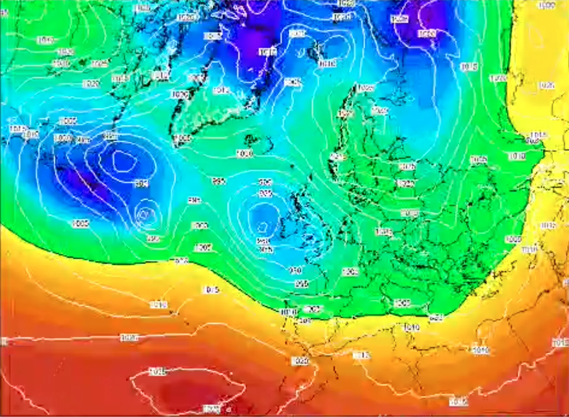
Heavy rainfall, unusual snowfall, and sharp drops in temperature: Morocco has recently experienced an extraordinary weather sequence. According to climatologist Saïd Karouk, these events are neither accidental nor isolated. They result from an exceptional convergence of global climate mechanisms—La Niña, a negative North Atlantic Oscillation, a humid equatorial air flow, and a disrupted polar vortex—amplified by climate change and indicative of a new climate regime with lasting impacts.
An exceptional climate configuration
The weather conditions observed in Morocco over recent weeks are the result of a rare convergence of several major climate phenomena. “Seeing these mechanisms act together is truly exceptional,” explains climatologist Saïd Karouk. This situation goes far beyond a typical winter disturbance and reflects a broader global climate dynamic.
At the heart of this configuration lies La Niña, a phenomenon marked by abnormally cold surface waters in the equatorial Pacific Ocean. The Pacific plays a central role in regulating the global climate, as it feeds the climate system through the redistribution of thermal energy stored in the oceans.
La Niña and the weakening of the Azores High
Unlike El Niño, which strengthens the Azores subtropical high-pressure system and promotes drought across North Africa, La Niña weakens this anticyclone. This weakening allows Atlantic disturbances to move southward and reach Morocco.
At the same time, a negative phase of the North Atlantic Oscillation (NAO) has set in. This regional configuration favors the southward intrusion of cold polar air toward mid-latitudes. When this cold air encounters warm, moisture-laden Atlantic air over Morocco, the conditions become highly favorable for active weather systems.
Air mass confrontation and intense precipitation
This thermal contrast explains the heavy rainfall and significant snowfall, particularly over mountainous areas. According to Saïd Karouk, such mechanisms have occurred in the past, but their current intensity is being amplified by climate change, especially through the increased capacity of the atmosphere to retain water vapor.
As a result, once saturation thresholds are reached, precipitation returns in a more abrupt and concentrated manner.
An exceptional equatorial flow from the Caribbean
Late January was marked by an even rarer phenomenon: the arrival of a highly humid equatorial air mass originating from the equatorial Atlantic and the Caribbean. Although these regions are typically associated with cyclonic activity, no cyclones formed. Instead, this warm, moisture-saturated air was drawn toward Morocco by a push of cold air descending from the Canadian polar region via Labrador.
The outcome was a composite air flow, combining cold polar air with warm, humid tropical air, traveling through a narrow and direct atmospheric corridor toward Morocco, significantly enhancing precipitation while maintaining low temperatures.
The key role of the polar vortex
Another major mechanism also played a role: the disruption of the polar vortex. An abnormal increase in stratospheric temperatures weakened this normally stable mass of cold air confined around the North Pole. Consequently, extremely cold air masses spread toward North America, Russia, and Asia, with indirect effects reaching the North Atlantic and North Africa.
This weakened vortex fueled deep low-pressure systems, generating strong winds, intense cold, and widespread disturbances extending as far as Morocco.
Climate change as the underlying driver
For Saïd Karouk, climate change acts as a powerful amplifying factor. It increases atmospheric moisture content and disrupts the global water cycle. Droughts are becoming longer and more severe, while rainfall events, when they occur, are more intense and less predictable.
This altered precipitation pattern signals the emergence of what the climatologist describes as a “new climate”, driven by the increasing energy balance of the Earth system.
Flooding: a challenge of infrastructure adaptation
Flooding, he stresses, is not solely a climate issue but also an infrastructure challenge. Two conditions must coincide: rainfall exceeding regional averages and urban drainage systems unable to absorb the incoming volumes of water.
Most existing infrastructures were designed according to 20th-century climate standards, which are now obsolete. This mismatch significantly increases urban vulnerability to extreme weather events.
Rehabilitating rather than reacting
While integrating new climate data into future projects is relatively straightforward, rehabilitating existing infrastructure represents a major technical and financial challenge. Expanding and upgrading major urban drainage collectors—such as those implemented in Casablanca after the 2010 floods—has become a national priority.
Dams: balancing storage and protection
Dams play a dual strategic role: storing water for drought periods and protecting populations from floods. Saïd Karouk recalls that management errors during the 2009–2010 episodes exacerbated risks due to excessive reservoir filling followed by emergency releases.
He advocates for anticipatory management, with controlled releases initiated well before critical thresholds are reached.
Toward permanent climate vigilance
Although the recent conditions remain exceptional, they could recur in a context of ongoing global warming. This makes continuous monitoring of oceans and key climate indicators essential from the start of each hydrological year.
For Saïd Karouk, adaptation is no longer optional—it is an urgent necessity if Morocco is to strengthen its resilience in the face of a rapidly changing climate.


